


Collector for ArcGIS

Collector for ArcGIS ၏ ရွင္းလင္းခ်က္
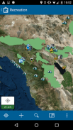
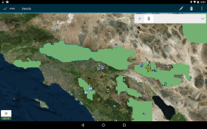
Use maps anywhere to ground truth your data, make observations, and respond to events. You'll improve the efficiency of your field workforce and the accuracy of your GIS.
Features:
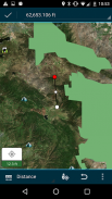
- Collect and update data using the map or GPS
- Download maps to your device and work offline
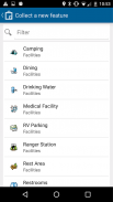
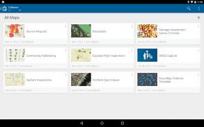
- Collect points, lines, areas, and related data
- Fill out easy-to-use, map-driven forms
- Attach photos to your features
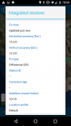
- Use professional-grade GPS receivers
- Search for places and features
- Track and report where you've been
- Integrate with Navigator for ArcGIS
- Integrate with Workforce for ArcGIS
အသုံးပြုမှုမြေပုံဘယ်နေရာမှာမဆို, သမ္မာတရားကိုသင့်ရဲ့ဒေတာမြေလေ့လာတွေ့ရှိချက်ဖြစ်စေနှင့်ဖြစ်ရပ်များတုံ့ပြန်ရန်။ သင်သည်သင်၏လယ်ပြင်လုပ်သားအင်အား၏ထိရောက်မှုနှင့်သင့် GIS ၏တိကျမှန်ကန်မှုကိုတိုးတက်စေပါလိမ့်မယ်။
အင်္ဂါရပ်များ:
- မြေပုံသို့မဟုတ် GPS သုံးပြီး data ကိုစုဆောင်းပါနဲ့ update လုပ်
- သင့်စက်ကိရိယာနှင့်အလုပ်အော့ဖ်လိုင်းမှမြေပုံ Download
- မှတ်, လိုင်းများ, ဒေသများနှင့်ဆက်စပ်ဒေတာစုဆောင်း
- လွယ်ကူတဲ့အသုံးပြုမှု, မြေပုံမောင်းနှင်ပုံစံများထုတ်ဖြည့်ပါ
- သင့်ရဲ့ features မှဓါတ်ပုံပူးတွဲ
- ပရော်ဖက်ရှင်နယ်-grade ကိုဂျီပီအက်စ်အသံဖမ်းသုံးပါ
- သောအရပ်နှင့် features တွေကိုရှာရန်
- သင်ခဲ့ဖူးတဲ့ဘယ်မှာနောက်ကြောင်းခံလိုက်နဲ့သတင်းပို့
- ArcGIS ဘို့ Navigator နှင့်အတူပေါင်းစပ်
- ArcGIS များအတွက်လုပ်သားနှင့်အတူပေါင်းစပ်
Collector for ArcGIS - ဗားရွင္း 18.0.3
(02-03-2020)
Collector for ArcGIS - APK သတင္းအခ်က္အလက္
APK ဗားရွင္း: 18.0.3package: com.esri.arcgis.collectorCollector for ArcGIS ၏ ေနာက္ဆုံးဗားရွင္း
အျခား ဗားရွင္းမ်ား


က႑တူအက္ပ္မ်ား

သင္ႏွစ္သက္ႏိုင္သည္မ်ားမွာ...


